![Cycling Spruce Knob, West Virginia Cycling Spruce Knob, West Virginia - sign for Spruce Knob, Highest Point in West Virginia, Monongahela National Forest]()
Cycling Spruce Knob
Ride 11.6 miles gaining 2,918’ at 4.7% average grade.
This extraordinary ride takes us to the highest paved location in West Virginia (and, with a brief hike, to the highest point in the state). At 4,863’, Spruce Knob is also the highest peak in the Allegheny subrange of the Appalachian Mountains. The Spruce Knob bicycle climb is located within the Monongahela National Forest (921,000 acres, includes much of the Potomac Highlands Region), within the Allegheny Mountains.
![Cycling Spruce Knob, West Virginia Cycling Spruce Knob, West Virginia - photo collage, bike parked in front of NPS sign for Spurce Knob, Monongahela National Forest, two-lane highway roadway and one-lane curved roadway, both covered in dense bright yellow and orange fall foliage, PJAMM Cycling logo in corner]()
Spruce Knob is the hardest bike climb in West Virginia.
“Very likely the most difficult overall climb in West Virginia, Spruce Knob is a fairly long ascent that takes you to the highest point in the state. Be ready early on this one as it has a sting over its opening miles. Quite isolated as it is located toward the center of this mountainous state, the road almost immediately reaches double digit grade as you head up the ridge. Solid 9-12% slope gets one warmed up quite quickly and you catch your breath as well. Around mile 2.5 the two lane road squeezes down to a wide single lane and thick woods close in as well as a grade ease. From this point the grade remains stout for another half mile and then eases further. From here to the top you ride over mostly shallow variable slope and through a few switchbacks. The trees only part in a few places along this stretch of climbing. At mile 9.8 turn right to get the very top of the mountain. This finishing stretch contains more stout grade in places along with long views toward the very top. The grade eases just before the summit among spruce trees which is the top section of a parking area with restrooms. There may be a bit of traffic on the road on good weather weekends but not enough to ruin the climb.” (This quote provided with the approval of John Summerson from his book, The Complete Guide to Climbing (by Bike), 2nd Edition, pg. 100.)
![Cycling Spruce Knob, West Virginia Cycling Spruce Knob, West Virginia - photo collage, bike parked against roadsigns at ride's start, PJAMM Adventure App with climb grade and profile, PJAMM Cycling logo in corner]()
Photo left: Start of the climb.
Photos right: PJAMM Adventure App showing elevation grid, etc.
![Cycling Spruce Knob, West Virginia Cycling Spruce Knob, West Virginia - photo collage, signs for Spruce Knob and Spruce Knob Lake, PJAMM Cycling logo in corner]()
Stay left on Briery Gap Road/Highway 33 at mile 1.7.
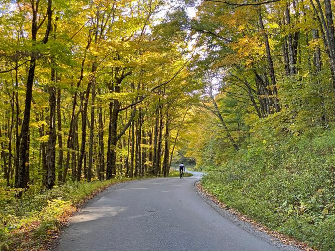
![Cycling Spruce Knob, West Virginia Cycling Spruce Knob, West Virginia - photo collage, views along Forest Road 112, dense fall foliage, mostly yellow and orange, sign for Forest Road 112, PJAMM Cycling logo in corner]()
Also stay right onto Forest Road 112 at the fork at mile 2.4 (not left onto Route 13/1-Simoda Road).
The first three miles of the climb are the most difficult, averaging 8.4%.
![Cycling Spruce Knob, West Virginia Cycling Spruce Knob, West Virginia - photo collage, scenery on middle portion of climb, steep grade in one-lane, well-paved roadway, dense tree coverage mostly yellow, cyclist climbing on steep roadway, PJAMM Cycling logo in corner]()
Scenery along the middle section of the ride.
Miles 4 to 11 are a breeze at a very consistent 4-5%.
![Cycling Spruce Knob, West Virginia Cycling Spruce Knob, West Virginia - photo collage, bike parked against tall skinny tree trunks in yellow-topped forestation along roadside, PJAMM Cycling logo in corner]()
![Cycling Spruce Knob, West Virginia Cycling Spruce Knob, West Virginia - panoramic views at overlook, fall foliage, mountains in background, bright blue skies, PJAMM Cycling jersey draped over post at overlook, PJAMM Cycling logo in corner]()
The only Overlook before the finish is at mile 8.7.
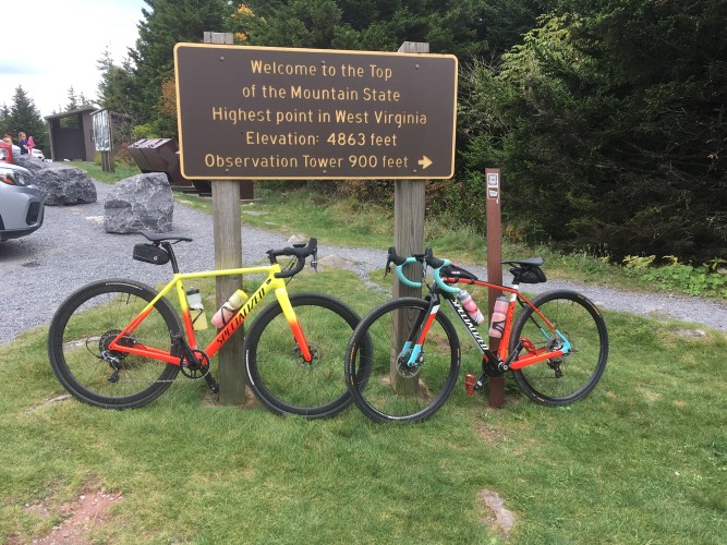
![Cycling Spruce Knob, West Virginia Cycling Spruce Knob, West Virginia - photo collage, two PJAMM Cyclists hold their bikes and wave next to sign for Spruce Knob Highest Point in West Virginia, bike parked next to sign stating "Welcome to the Top of the Mountain State, Highest Point in West Virginia," PJAMM Cycling logo in corner]()
![Cycling Spruce Knob, West Virginia Cycling Spruce Knob, West Virginia - observation tower at Spruce Knob summit]()
Photo: Observation tower at the summit of Spruce Knob, West Virginia
Wikimedia Commons - Famartin
Roadway Surface and Traffic Report: The road was in good shape in October 2020 and there is minimal traffic on this bike climb. The descent is very fun and you can hit pretty good speed over the last three miles towards the finish.
Parking: There is parking on Route 28 near the start of the climb.
![]()
That’s a wrap!

 We've partnered with Sherpa-Map.com to bring you the best route planning tool. With a PRO Membership you can use this climb as a reference when creating your route.


